Majdan Górny
Borough of Tomaszów Mazowiecki, Tomaszowski District, Lubelskie VoivodeshipType of place
Forest gorge.Information about the crime
In September 2021, we conducted a site inspection of the Jewish war grave in Majdan Górny. We met an eyewitness to the murder of a group of Jews, including a woman with a baby in her arms. Mr. Franciszek D. was a child back then: “I know more or less where it was, but many years have passed, they have evened the ground, there is no sign. I was grazing cows when Germans brought Jews here. I only remember that one woman was carrying a baby in her arms. It was very close, more or less where this building stands. Maybe even closer. […] There was a path here before. The woman was carrying her baby, when suddenly a German took out a gun. Bang! Bang! One young Jew tried to run away. There were more of these young Jews. They shot him in a ditch. There was a wasteland forest here, and near this forest there was a path to Polesie which led to the main road to Tomaszów. There was a ditch here, and he tried to run down that ditch, between the bushes. The Germans chased him along the road and across the field. The Jew had no choice. He ran down that ditch, and when he ran out of it, the Germans caught him. He wouldn’t run away anyway … “(Majdan Górny, September 22, 2021)
The next generation of the D. family know the story of a murder of a group of Jews. The daughter of Franciszek showed us the potential place of burial. It is located in a forest gorge, at the bottom of a high escarpment.
The Register of Killing Sites and Crimes from the former zamojskie province records that in 1942, the Gestapo and SS officers shot about 25 Jewish people in Majdan Górny. Szajman with his wife and children were among the killed. The victims probably came from Majdan Górny and the surrounding area. The bodies were buried at the crime scene.
IDENTIFICATION OF THE GRAVE BASED ON NON INVASIVE RESEARCH
On 03.12.2023, a site visit was carried out at a place precisely indicated (GPS: N50°27.542′ E023°29.181′) by the witness’s family as the location of a mass grave of 10-15 victims. The burial site is located in the ravine at a characteristic elevation of the ravine floor (attachment Majdan Górny photo 1/2/3 locations), which was marked on the terrain measurement (attachment Majdan Górny LiDAR 1,2).
In 2024, research was carried out using georadar (MALA X3M/ 500 Mhz). 8 echograms were collected with the names: MJN10001-MJN10007. The echograms marked (Majdan Górny, echogram compilation MJN1) disturbance of soil layers at the site of the mass grave of 10-15 victims. The recorded anomalies appear at approx. 1.8 m – 6.0 m, depth approx. 0.8 – 1.0 m below ground level. The probable format of the grave is: length approx. 4.2 m, width approx. 2.1 m, depth approx. 0.8 – 1.0 m below ground level.
No search of archival aerial photographs for this area was conducted.
The research carried out in 2024 was funded by the European Union NextGenerationEU.
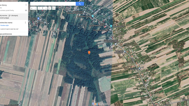 Majdan Górny fotografia satelitarna 1a
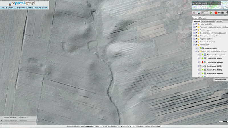 Majdan Górny LiDAR 1
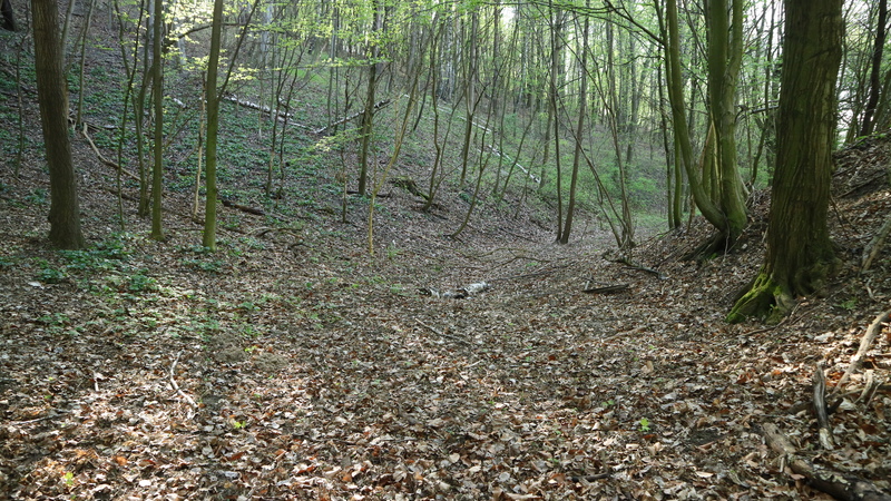 Majdan Górny fotografia 1 lokalizacji
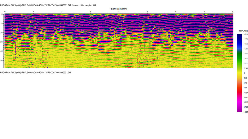 Majdan Górny MJN10001
Transkrypcje
Contact and cooperation
We are still looking for information on the identity of the victims and the location of Jewish graves in Majdan Górny, If you know something more, write to us at the following address: fundacjazapomniane@gmail.com.
Bibliography
Recording of the Zapomniane Foundation (audio file), Franciszek D. resident of Majdan Górny b. in 1934, keywords: Jewish grave in Majdan Górny; exp. Agnieszka Nieradko, Ewa Koper and Marek Kołcon, Majdan Górny, September 22nd, 2021
IPN GK 163/18 regarding Jewish war graves in the villages of the Tomaszów Lubelski province
The Register of Killing Sites and Crimes committed by the Germans in Poland between 1939 and 1945, zamojskie province, Warsaw 1994
We have collected the materials about this village thanks to the funding provided by the International Holocaust Remembrance Alliance as part of the project “The rural Holocaust. Collecting and safeguarding the never recorded testimonies 100 forgotten Jewish graves 2021-2022” and also thanks to the support of the Embassy of the Federal Republic of Germany in Warsaw.


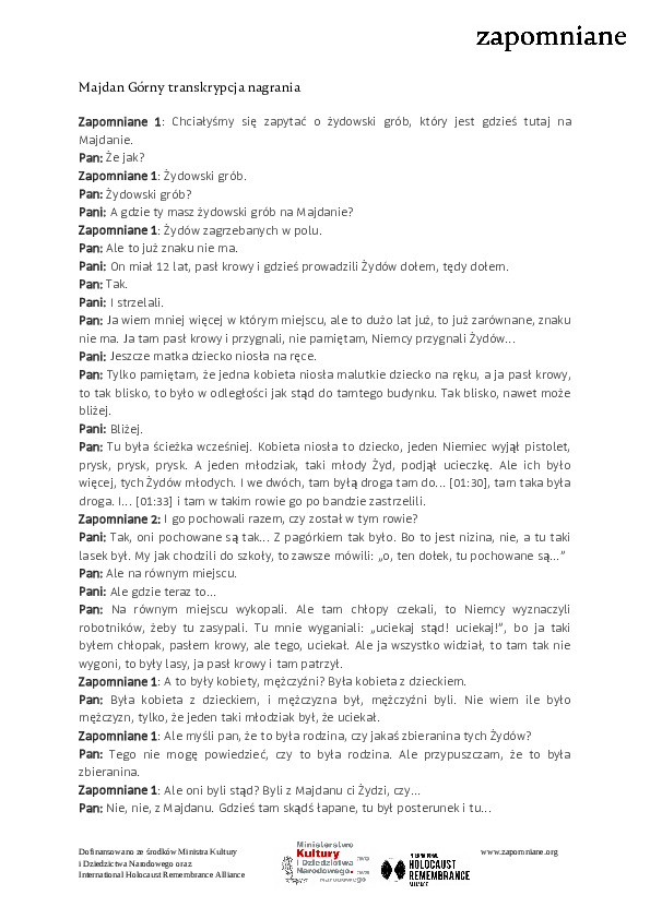 Majdan Górny transkrypcja nagrania