Łomża
Borough of Łomża, Łomża District, Podlaskie VoivodshipType of place
The Jewish cemeteryInformation about the crime
The Jewish cemetery at Boczna Street in Łomża was a killing site of both Christians and Jews. According to scouts report (Alert Harcerski) made by the scouts from the school no 9 in Łomża, 350 people were killed on the cemetery (including 200 Jews.) “In 1940-45 Germans brought prisoners from the prison in Łomża to the cemetery where all of them were shot. They were mostly Jews.” (Gk 195/I/12) Names of ten people murdered and buried on the cemetery between 1941 and 1942 are known:
Adam Berkman
Berman
Boczkowski
Budzik
Gołąbek
Estera Gurfinkiel
Niedźwiecki
Roksztajan
Urwicz
Zimny
IDENTIFICATION OF THE GRAVE BASED ON NON INVASIVE RESEARCH
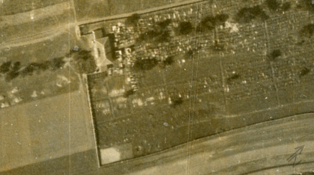
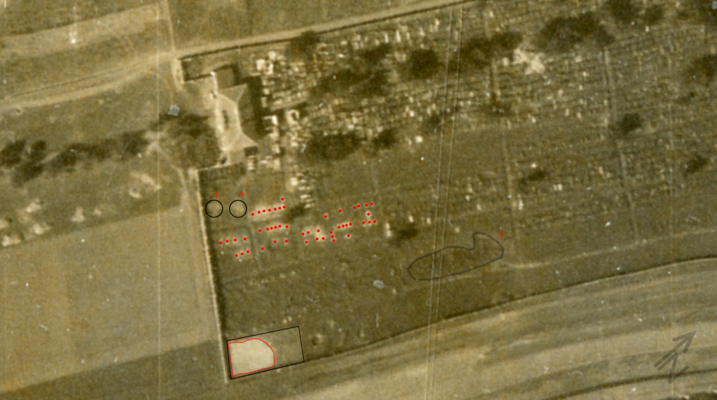
An air photography query was conducted for this area, which resulted in obtaining two photographs from 17th of April 1941 and 20th of September 1944. Interpretation of an aerial photograph from 20th of September 1944 has indicated a ground disturbance with relatively straight edges, its shape suggests that this is a result of a human excavation. It is located in the south-eastern corner of the cemetery. The supposed size is a width of approx. 10 m, length approx. 12 m. In the southern part of the cemetery there are clearly visible individual excavations located in six cemetery quarters. Numerous ground disturbances of a small size: length approx. 2 m, width approx. 0.70 – 1 m are certainly single graves of the victims of war, as these excavations are not visible in the photograph from 17th of April 1941.
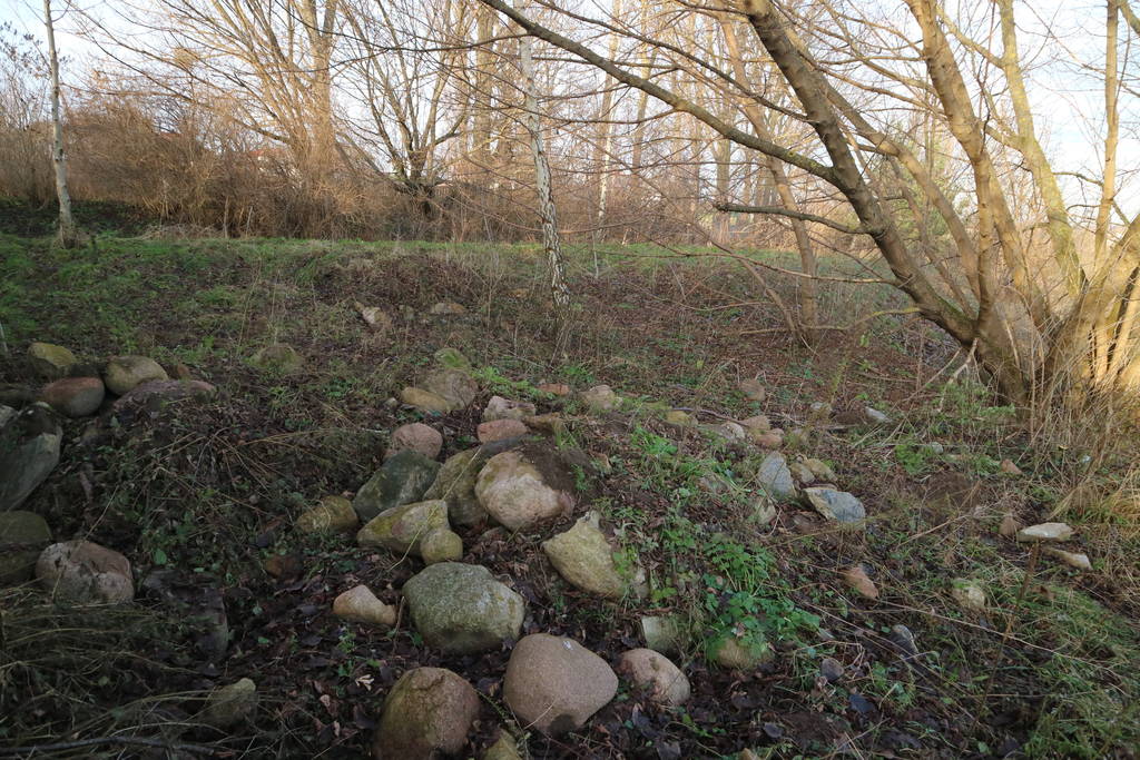
During the site location at the Jewish cemetery on the 11th of December 2017, a place was found in the south eastern corner (GPS: N53°10.164’E022°05.321′) outside the fence of the Jewish cemetery. This location is distinguished by the selected sand from the cemetery’s slope covered by the field stones. Locations of individual war graves located in the quarters in the southern side of the cemetery (GPS: N53°10.185′ E022°05.297′, N53°10.190′ E022°05.306′, N53°10’10.62″ E022°5’17.99″, N53°10’10.51″ E022°5’17.32″, N53°10’10.14″E022°5′ 18.19″) are now densely overgrown and access to them is limited.
No GPR surveys have been conducted.
The LIDAR survey indicates depression after excavated land in the south-eastern corner of the cemetery.
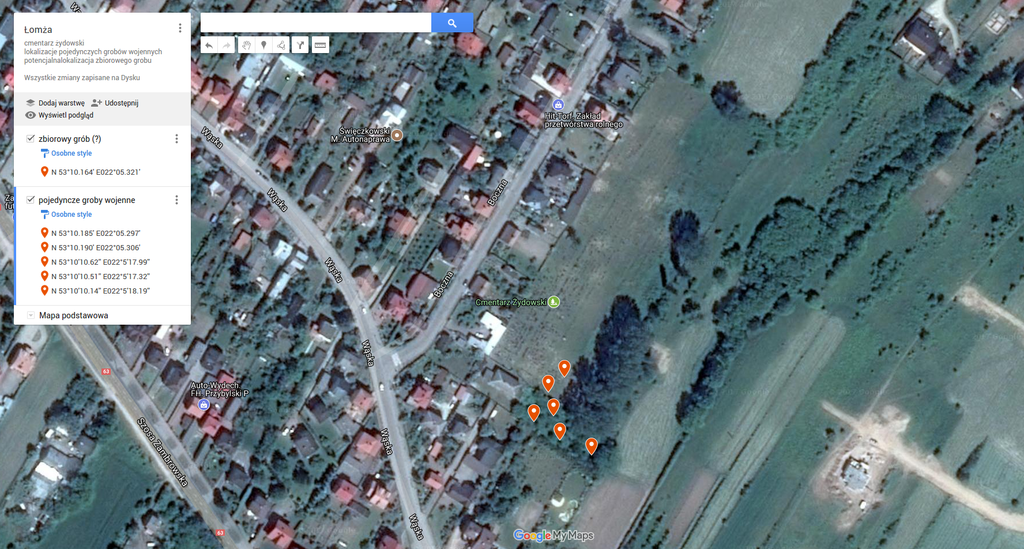 Łomża fotografia satelitarna 1e
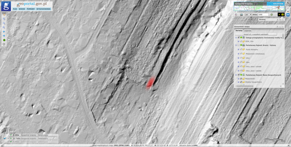 Łomża lidar 1d
 Łomża fotografia lotnicza 17.04.1941r
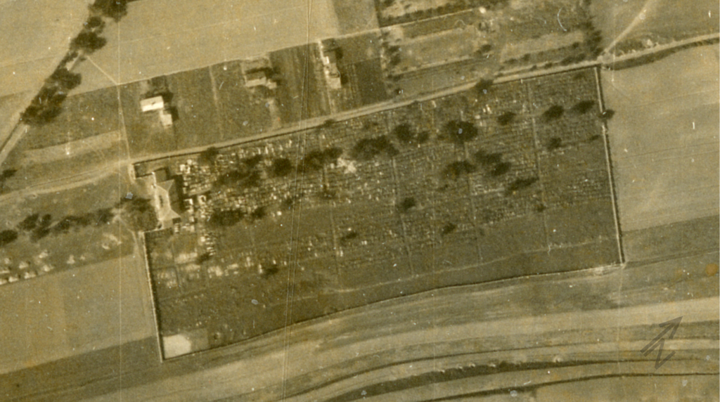
 Łomża fotografia 1 lokalizacji 1
Contact and cooperation
We are still looking for information on the identity of the victims and the location of Jewish graves in Łomża. If you know something more, write to us at the following address: fundacjazapomniane@gmail.com.
Bibliography
In appreciation to the Conference on Jewish Material Claims Against Germany (Claims Conference) for supporting this research project. Through recovering the assets of the victims of the Holocaust, the Claims Conference enables organizations around the world to provide education about the Shoah and to preserve the memory of those who perished.
![]()