Pilica
Borough of Pilica , Zawierciański District, Śląskie VoivodshipType of place
Jewish cemetery in PilicaInformation about the crime
The Register of Killing Sites and Crimes for the former katowickie Voivodeship has recorded the following events in Pilica:
“- On November 5, 1942, Gestapo and military police officers from Miechów and Wolbrom shot about 20 people of Jewish origin. The names of the victims remain unknown. The bodies were buried in the cemetery.
– In the autumn of 1943, military policemen shot several Jews in the Jewish cemetery. The names of the victims remain unknown.
– In the winter of 1944, military policemen shot 3 Jews at the Jewish cemetery”.
We also obtained questionnaires on mass executions and mass graves dated September 27, 1945. They refer to the events of autumn 1942 and January 1943. According to the first of the questionnaires, the autumn execution of 1942 took place on September 5, and “the names of the victims remain unknown, because the Germans transported some of the Jews to Wolbrom, and shot the rest, about 20 people, immediately. It was impossible to determine which ones they took away and who were shot on the spot. The victims were buried in a mass grave with dimensions 2 x 10 m.” (IPN Gk 163/11)
The names of the 70 people murdered in January 1943 also remain unknown. “They were transported from the surrounding villages and executed in the next few days”. According to the same documents, 20 murdered people were buried in the Jewish cemetery in mass and single graves, “which are impossible to find because the Germans ordered to level the ground right away and trees and bushes grow there now”. (IPN Gk 163/11)
IDENTIFICATION OF THE GRAVE BASED ON NON INVASIVE RESEARCH
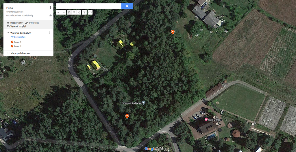
On February 14, 2022, we carried out site inspection at the Jewish cemetery to determine the location of mass graves and determined a place in the north-eastern corner of the plot. (GPS: 50°27’12.6″N 19°38’38.3″E)
This location is characterised by a depression in the terrain visible on the LiDAR survey. The approximate format of the depression is approx. 16.0 m x 12.0 m. In addition, LiDAR shows another distinct sinkhole located near the south-western corner (GPS: 50°27’09.4″N 19°38’35.6″E), with approximate dimensions of approx. 13.0 m x approx. 13.0 m.
As a result of the aerial photography query, a photograph with the signature TU GX 862 frame 2 001 (1944) was obtained. The picture shows the area of the Jewish cemetery. The fence of the cemetery appears it the photograph. The vegetation in the north-eastern corner of the cemetery makes interpretation of the area in terms of ground disturbance impossible. There are no clear traces of violations in the western part of the cemetery.
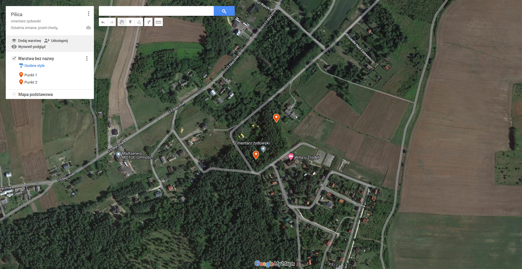 Pilica fotografia satelitarna 1a
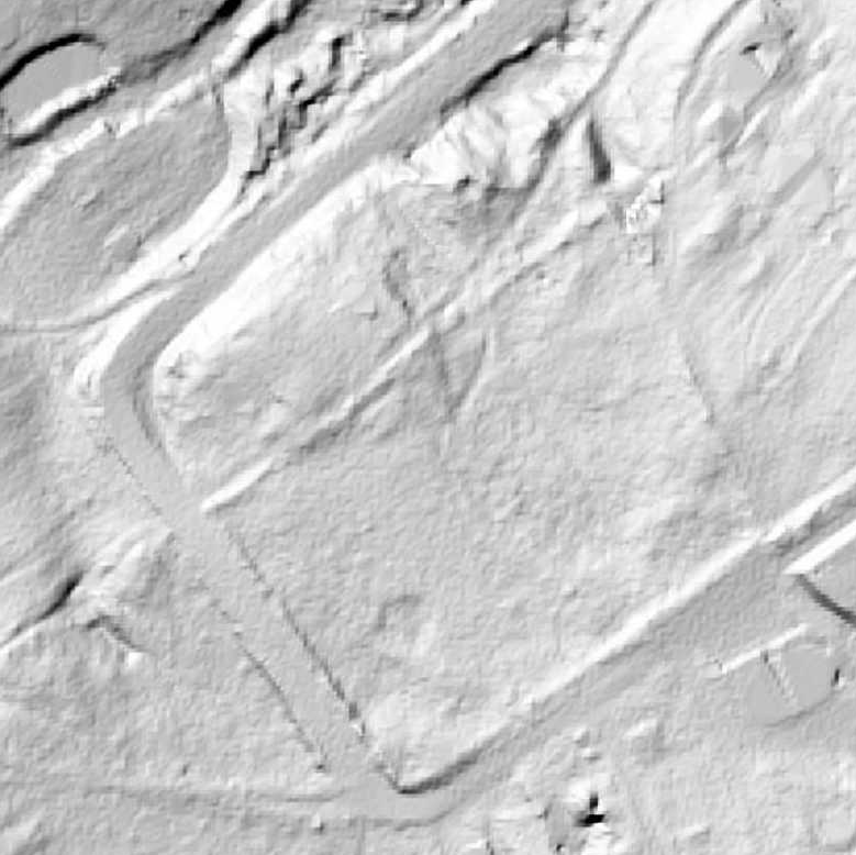 Pilica LiDAR 1
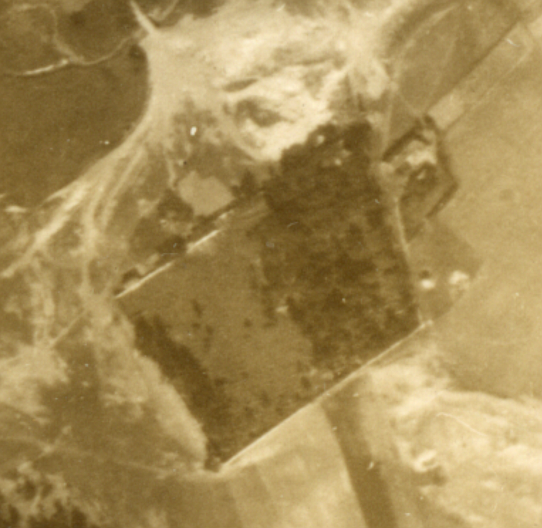 Pilica fotografia lotnicza 1944
 Pilica fotografia lokalizacji
Sources
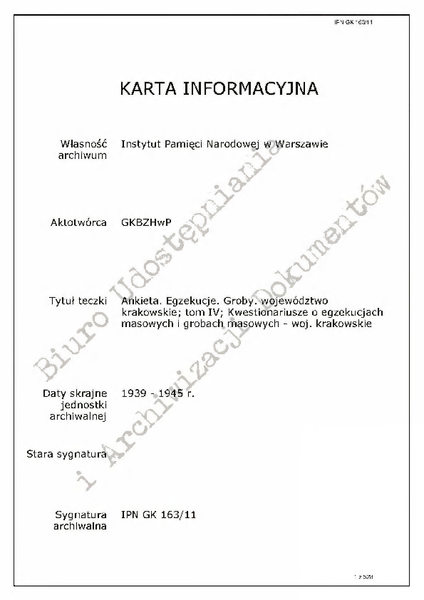 IPN GK 163-11 Ankiety. Egzekucje. Groby. Województwo krakowskie - Pilica
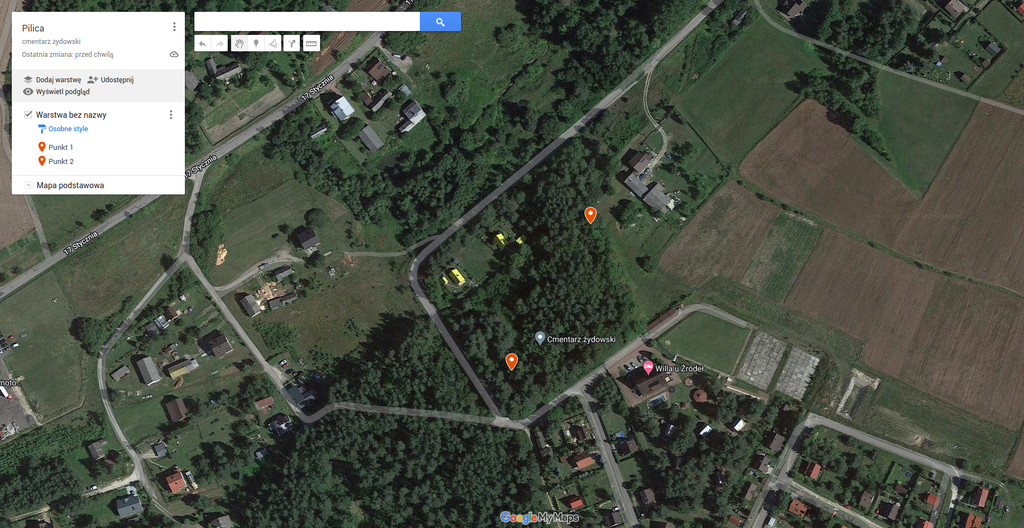
Contact and cooperation
We are still looking for information on the identity of the victims and the location of Jewish graves in Pilica. If you know something more, write to us at the following address: fundacjazapomniane@gmail.com.
Bibliography
IPN Gk 163/11 Questionnaire. Executions. Graves. Kraków province ; volume IV; Questionnaires about mass executions and mass graves – Kraków province
IPN Gk 196/323 The trial of Józef Buhler
IPN BU 2448/478 Jewish war graves in Pilica
IPN BU 2448/479 Jewish war graves in Pilica
The Register of Killing Sites and Crimes committed by the Germans in Poland between 1939 and 1945, katowickie province, Warsaw 1985
We have collected the materials about this village thanks to the funding provided by the International Holocaust Remembrance Alliance as part of the project “The rural Holocaust. Collecting and safeguarding the never recorded testimonies 100 forgotten Jewish graves 2021-2022”. The materials for this website were developed, digitized and made available as part of the project “Development of a digital archive of Jewish war graves outside the extermination camps and educational use of archive resources” thanks to funding from the Minister of Culture and National Heritage from the Cultural Promotion Fund.
![]()