Mińsk Mazowiecki
Borough: Mińsk Mazowiecki, District: miński, Voivodeship: mazowieckieType of place
Jewish cemetery in Mińsk Mazowiecki.Information about the crime
The ghetto in Mińsk Mazowiecki was established in 1941, between Mostowa and Warszawska streets, with the Srebrna River forming its natural southern border. Its average population was 7,000 people. “In 1941, Jews were rounded up from across the city and ghettos were established. Men with professions (tailors, locksmiths) were selected from the ghetto. In addition, special closed camps were created, located in a school on Siennicka Street, at the Piłsudski barracks, and at the Rudzki bridge construction factory in the Stankowizna district. Two years later, individual camps began to be liquidated, with working Jews being taken en masse to the Jewish cemetery, where they were executed by shooting in front of pre-dug graves. The rest of the ghetto population was transported to an unknown destination. Their fate remains unknown.” (IPN Bu 2448/961)
The largest liquidation operation, i.e. the massacre of the ghetto inhabitants and their deportation to the Treblinka extermination camp, took place on 21 August 1942. On that day, 1,700 people were killed, and their bodies were buried in the local Jewish cemetery. (IPN Gk 163/43)
One of the most tragic chapters in the extermination of the Mińsk Ghetto prisoners are the events that took place in early 1943: “After gathering the Jews in this area, the Germans began liquidating the ghetto at the very beginning of the occupation. Most of the Jews were brutally loaded onto trains and deported. The part of the Jewish population that remained in the ghetto for forced labor was shot. The executions took place on the site of today’s School No. 4. The Jews even tried to defend themselves, but their resistance was brutally suppressed. This happened on January 6, 1943. (IPN Gk 195/XV/8)
The description of events at the school on Sienkiewicza Street also appears several times in the scout alert:
“Until 1942, there was a school there. From 1943, Jews were gathered here and isolated from society with barbed wire – a small Jewish ghetto. By 1944, all Jews had been brutally murdered. Today, Primary School No. 4 stands on this site once again. There is no memorial plaque. […] During the war, the site of today’s School No. 4 in Mińsk Mazowiecki was occupied by Copernicus Primary School. In August 1942, the Germans closed the school and housed Jews from the surrounding area in the building, where they were forced to work for them. The Germans killed these people slowly. Escaping from the ghetto was impossible, as it was surrounded by barbed wire. German guards were also posted around it. A large group of Jews from this ghetto was deported by the Germans to Treblinka, while others were killed on the spot. In 1943, the German fascists killed all the Jews here and burned down the school. […] In 1942, the Germans began deporting Jews to Treblinka. Before that, they had gathered the scattered Jews in the Copernicus School on Sienkiewicza Street. Seeing that their end was near, the Jews began to defend themselves desperately. The Germans then threw grenades at the school and set it on fire, along with the Jews who remained inside. Jews were brought to the Jewish cemetery – the ‘kirkut’ – where the Germans buried them almost alive.” (IPN Gk 195/X/8)
“An incident at the school on Sienkiewicza Street – the Jews refused to leave, so the school was set on fire and several people were burned alive, while the rest left and were shot in the cemetery.” (IPN BU 2449/961). The quoted survey of the Chief Commission for the Examination of German Crimes was drawn up on 8 November 1968 in Gorzów Wielkopolski, based on testimony provided by Marceli Rzepkowski, who was living there at the time. As a result of these events, approximately 600–700 people were murdered. In the same questionnaire we read: ‘In the course of the ghetto’s liquidation, the Germans took a large group of Jews out of the school and led them toward the Jewish cemetery. After an escape attempt, they were shot.’ The Jews who remained in the school set fire to the straw mattresses and attempted to escape. In response, the Germans dragged the Jews out of the building one by one and shot them in the school courtyard, pushing the next victims onto a pile of bodies, until all were shot.” (IPN BU 2449/961)
Brustin-Berenstein also mentions the massacre of Jews imprisoned in the school: “In December 1942, 218 people from the labor column at the Copernicus School were taken to the cemetery and shot. On 10 January, the remaining members of this column were executed amid resistance.” (Bulletin of the Jewish Historical Institute, Warsaw, January-June 1952, No. 1(3))
Besides the graves at the Jewish cemetery, unmarked graves of Holocaust victims may be located elsewhere in the city. In 1942, a massacre took place on the square, resulting in the deaths of 10 people—four men and six women. According to a 1969 survey, “they lie in the square where [they] were shot; currently, a grain warehouse has been built there. There was no exhumation. They were buried by Wacław P., a resident of Mrozy.” (IPN BU 2448/961)
The locations where mass murders “predominantly of Jewish people” were committed include a gravel pit on the road from Mińsk to Niedziałka, the railway station opposite the semaphore in Mińsk, and Góra Choszczowska near Mińsk. (IPN Gk 185/13)
IDENTIFICATION OF THE GRAVE BASED ON NON INVASIVE RESEARCH
As a result of aerial photography query, an image from 1944 (No. 3506/293/2916, 13:15) was obtained, covering the area of the Jewish cemetery (GPS: N 52°10’26.406” E 21°34’56.582”) along with its historical boundaries (see attached aerial photograph and orthophoto map with the boundaries marked in red). The photograph shows numerous disturbances in the soil, characterized by a lighter shade of gray. In the central part of the plot, a cluster of lighter spots is visible, likely associated with gravestones and soil layer disturbances. Along the southern boundary, dark, elongated patches can be seen, which are overgrown depressions. In the north-western corner, there is visible regular soil disturbance in a light grey shade. In the eastern part of the cemetery, larger dark spots can be seen, which may indicate overgrown areas where disturbances occurred in the past.
If there are no witnesses who can indicate the sites of Holocaust mass graves, precisely identifying the burial sites is very difficult.
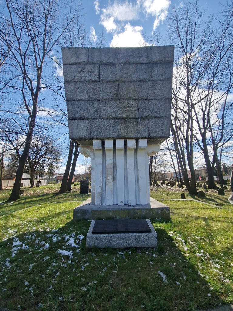
LiDAR terrain analysis indicates numerous minor soil disturbances, as well as clear depressions along the western, southern, and eastern edges of the cemetery plot. In the western part, the square leading from the gate to the monument and the monument itself can be seen.
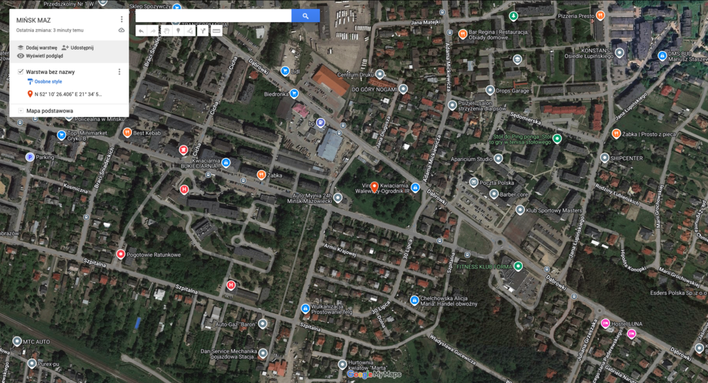 Mińsk Mazowiecki fotografia satelitarna 1a
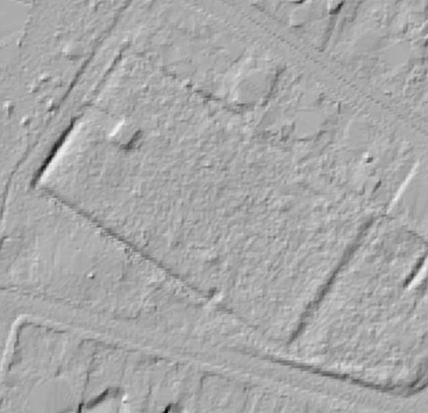 Mińsk Mazowiecki LiDAR
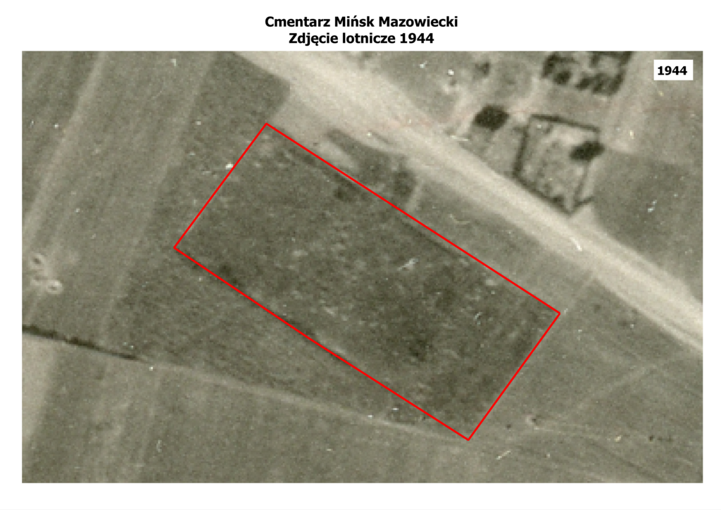 Mińsk Mazowiecki fotografia lotnicza
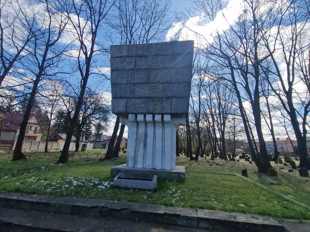 Mińsk Mazowiecki fotografia lokalizacji 1
Sources
 Mińsk Mazowiecki Kartoteka tematyczna Głównej Komisji Badania Zbrodni Hitlerowskich w Polsce
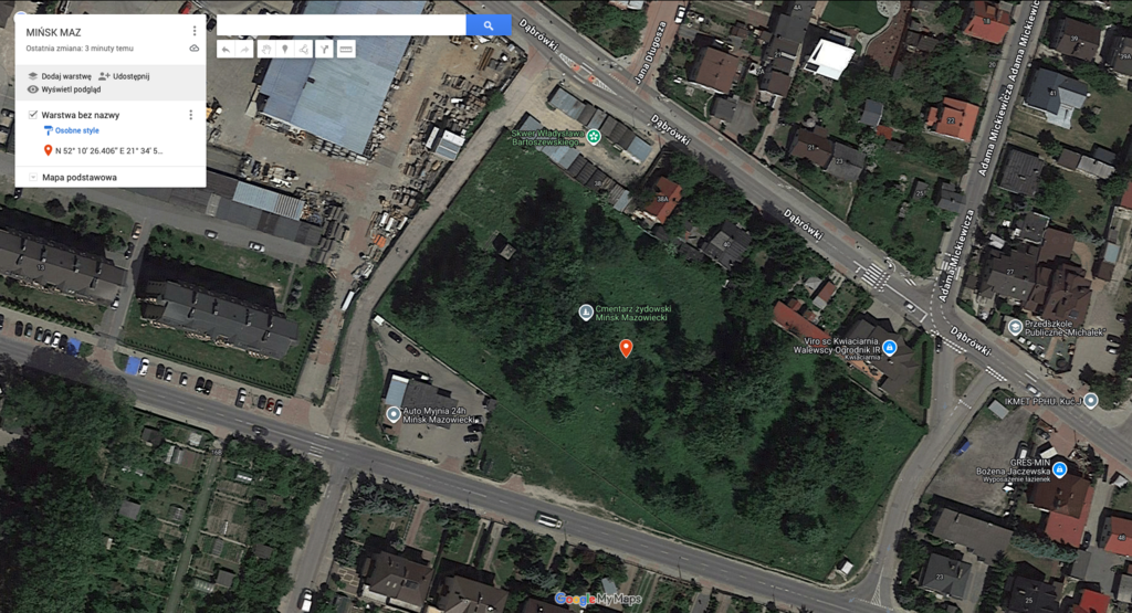
Contact and cooperation
We are still looking for information on the identity of the victims and the location of Jewish graves in Mińsk Mazowiecki. If you know something more, write to us at the following address: kontakt@zapomniane.org.
Bibliography
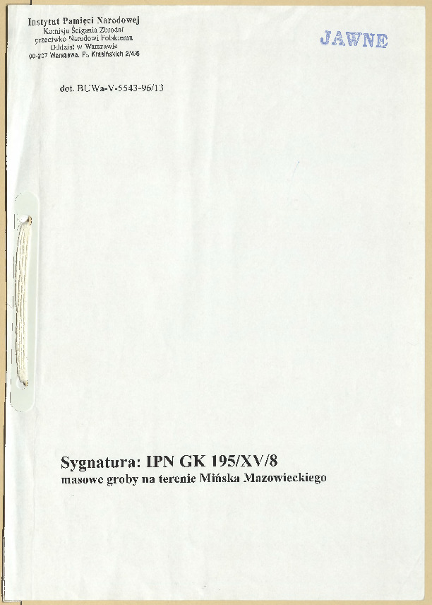
IPN Gk 195/XV/8, the Chief Commission for the Examination of German Crimes in Poland, warszawskie voivodeship, Mińsk Mazowiecki district, vol. XV, book 8
IPN Gk 163/61, Surveys of the Chief Commission for the Examination of German Crimes in Poland, Mińsk Mazowiecki District
IPN Gk 163/43, Surveys of Disctrict Courts, executions, graves 1939–1945, warszawskie voivodeship, volume III
IPN Gk 185/13 the Chief Commission for the Examination of German Crimes in Poland, warszawskie voivodeship, Reports
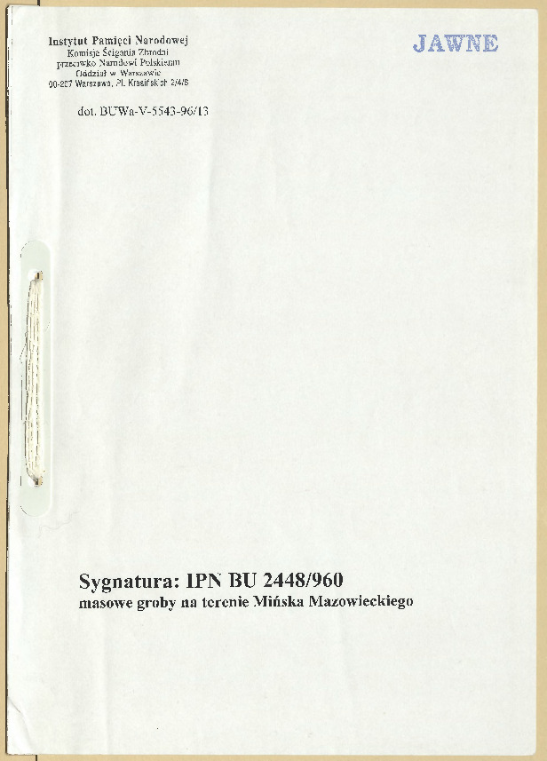
IPN Bu 2448/960 the Chief Commission for the Examination of German Crimes in Poland, executions, deportations to labour camps, arrests
IPN Bu 2448/961 the Chief Commission for the Examination of German Crimes in Poland, warszawskie voivodeship, Mińsk Mazowiecki district
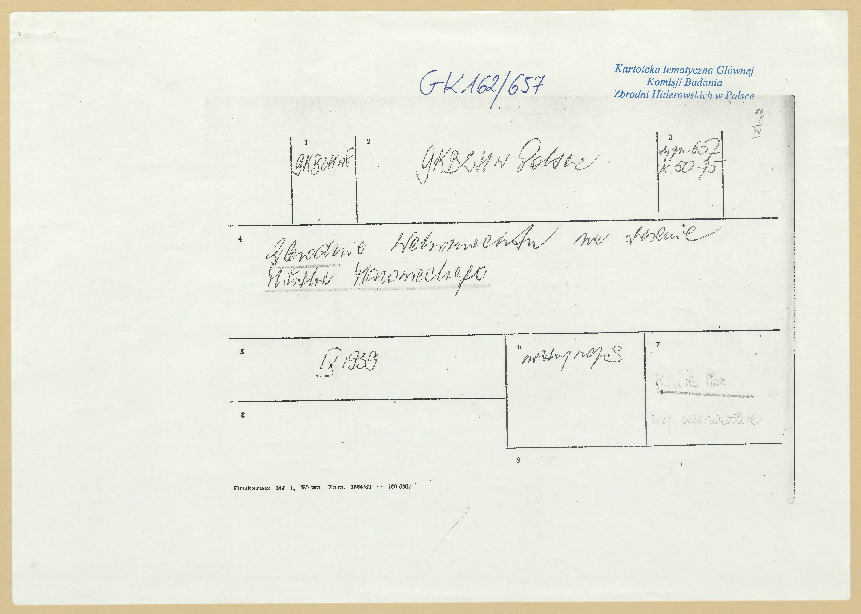
IPN Gk 162/657 Thematic files of the Chief Commission for the Examination of German Crimes in Poland, ref. 657, pp. 50–75
Burstin-Berenstien T. Deportacje i zagłada skupisk żydowskich w dystrykcie warszawskim (Deportations and extermination of Jewish communities in the Warsaw district), Jewish Historical Institute Bulletin, Warsaw, January–June 1952, no. 1(3).
The materials published on this website were developed, digitized, and made available thanks to funding from the Minister of Culture and National Heritage through the Culture Promotion Fund, as well as support from the Embassy of the Federal Republic of Germany in Warsaw, which also enabled the creation of the English-language version of the website.

![]()